|
2021 Global & Galaxy Links
Fifth pre-ice city found in Antarctica since September
By Mary Joyce, website editor
After Mary Hall found this fifth ancient city emerging from Antarctica’s melting ice, it was immediately blurred beyond recognition. Sadly, this is not the first time Google Earth images of ancient ruins in Antarctica have been blurred shortly after their discovery. |
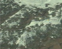
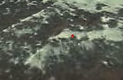
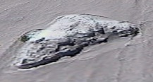
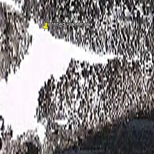
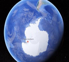
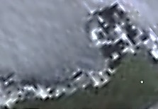
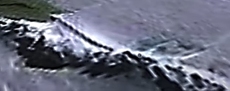
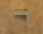
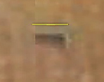
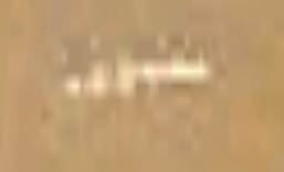
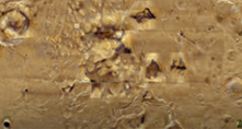
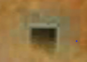
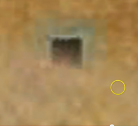
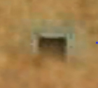
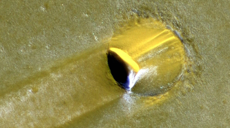
The image below shows a portion of the ancient city complex Mary Hall found on November 16, 2021. Compare it to the image on the right that we found after typing the same coordinates into the Google Earth search bar the next day.
72°04’17”S 4°33’07”E
Why, why, why are “they” hiding evidence that a pre-ice civilization once existed on Antarctica? Why is it so verboten for the public to know a civilization existed on that continent 34 million years ago? |
|
|
Click here to see Mary Hall’s video of this site:
https://www.youtube.com/watch?v=ptr2STX1ECg |
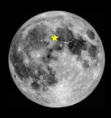 |
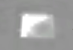
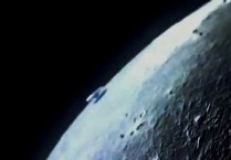
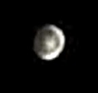
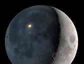
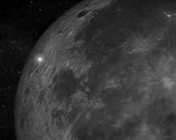
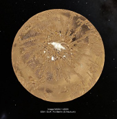
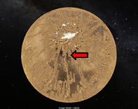
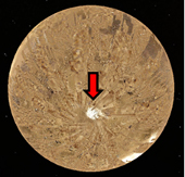
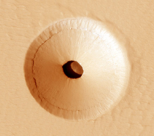
White pyramid on the Moon
Most unique discoveries on the Moon are found on its backside where they cannot be seen from Earth. So, it’s surprising that a white pyramid with sharp edges is perched on a hilltop on the side of the Moon facing Earth. The yellow star marks its location.
It is fairly good size, measuring about 328 x 328 feet. This means that each side is about 28 feet longer than a football field.
You can find it for yourself by coping and pasting the following coordinates into your Google Earth/Moon search bar:
23°57'14.32 N 4°25'46.20 E
|
|
|
NASA employee: Moon photos deliberately blurred
By Mary Joyce, website editor
We are fortunate whenever we find fairly clear photos of structures on the Moon because NASA artists have been airbrushing them out of photos for many years. |
 |
One NASA employee, Donna Hare (L), blew the whistle on the cover-up in 2000 on WOL-AM radio in Washington, DC when she declared that thousands of NASA photos over the years have been doctored or obfuscated.
This whistleblower is no peon. She was a NASA space illustrator and photographic slide technician who won many awards including the Apollo Achievement Award, Skylab Award and a commemorative medallion for meritorious service during the joint American/Russian Apollo-Soyuz space mission. |
|
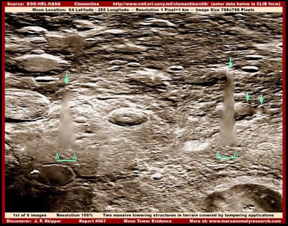
Thanks to sloppy airbrushing, the NASA photo below exposes the cover-up. Plus, the descriptive data at the bottom of the photo confirms it. One line says “Moon Tower Evidence.” The other line says “Two massive towering structures in terrain covered by tampering applications.” You can enlarge this NASA photo on your computer to more easily read the descriptive data for yourself.
|
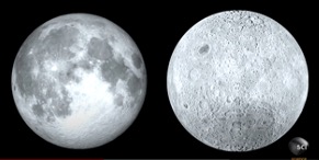 
Front and back sides of Moon – Illustration of two moons circling Earth in ancient times
Why backside of Moon is so different
By Mary Joyce, website editor
|
It’s been a big mystery. The backside of the Moon is paler and its crust is about 30 miles thicker than the side facing Earth. Well, a growing number of scientists say they have figured out why.
They believe two moons once circled Earth and gravitational pull kept drawing the two closer and closer, until the smaller one eventually smashed into the larger one creating a thicker crust on the Moon’s backside. Erik Asphaug, a highly-regarded planetary geologist, calls it “The Big Splat.” |

|
|
The thicker crust on the Moon’s backside also explains why the two sides of the Moon look different. According to the scientists, the thinner crust on the front side allows lava to occasionally spill out on the surface causing the darker areas that can be seen from Earth. By contrast, the thicker crust on the backside keeps a tight lid on lava within the Moon so its surface remains paler. |
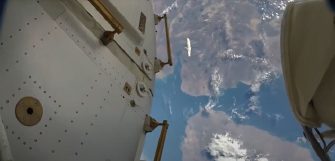
Faux moon flew past Space Station
By Mary Joyce, website editor
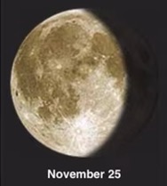
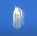
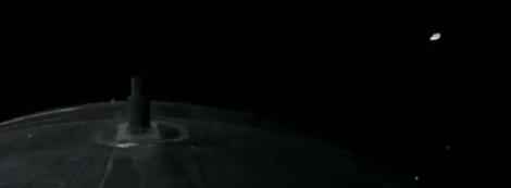
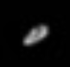
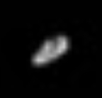
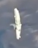
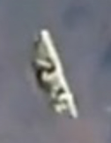
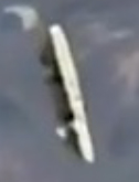
Our Moon suddenly appeared between the International Space Station (ISS) and Earth the night of November 25, 2021. But that’s not possible because the real Moon is way beyond the ISS - actually about 249,750 miles beyond it. Consider this impossibility another way. The ISS is only 250 miles above Earth and the diameter of the Moon is 2159 miles. There simply is not enough room for the Moon to fit between the ISS and Earth.
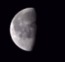 
(L) The blurry “moon” that appeared between Earth and the Space Station
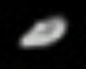
(R) Astronomical photo of the real Moon that same night
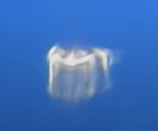
So, what was this “moon” that was captured by the ISS live-feed camera? Maybe the image was projected by an ET spacecraft as it passed by the ISS. Maybe NASA used hologram technology to bounce an image of the Moon off a passing spacecraft or satellite. That may sound farfetched but consider the following statement by Kathy Forti, PhD.
“The U.S. military and NASA have been experimenting with holographic projection since 1978 in a program known as Project Blue Beam. While many in the government and mainstream media try to debunk its classified existence, it’s become harder to deny, especially after the Chinese government openly projected a holographic city and alien spaceship into the sky for its own people in Guangzhou. The people were told in advance what the technology was so as not to cause wide spread panic. Consequently, everyone flocked to the area to film it.”
Below is one of the photos of a hologram city that appeared in the clouds over China in October 2015.

Holograms are not easy to explain but basically, they are created by projecting a laser beam image and bouncing it off mirrors in different locations. When the reflected images come together, a 3D image appears. With so many satellites circling the Earth, creating a phantom moon certainly might be possible.
We would like to thank Mary Hall who caught this “moon” while monitoring the ISS live-feed camera. To see the raw video feed of the faux moon and listen to Mary’s first thoughts about what she saw, click here: https://youtu.be/QUEjirAXSts
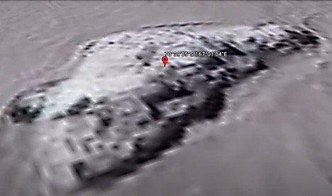
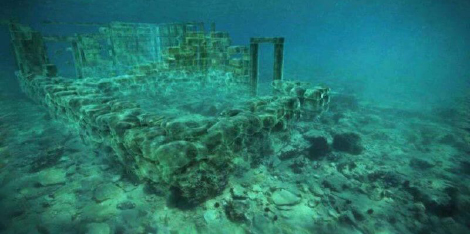
Island of Antarctic ruins found . . . then blurred
By Mary Joyce, website editor
The above island of structures was found in a sea of ice near the northeastern coast of Antarctica by Google Earth detective Mary Hall on May 23, 2021. This was a BIG DISCOVERY because Antarctica has been covered with ice for 34 million years so this most likely is a remnant of the world’s oldest civilization.
Since this discovery, Mary Hall and I have been searching for more ancient ruins emerging from Antarctica’s melting ice. You can see what we’ve found so far by scrolling down through this section of the website. |
This also is a cover-up story.
On November 13, 2021, we took another look at the “island” of structures. Sadly, the infamous “they” had blurred the Google Earth image of the site. Compare what we recently found (R) to the original image above. Other ancient Antarctic sites also have been blurred after we discovered them. |
|
|
CLICK HERE to watch Mary’s 2:28 minute video
which shows the “island” structures from many angles. |
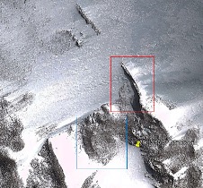
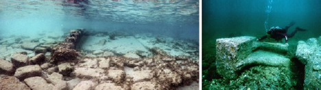
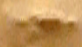
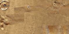
Antarctica’s pre-ice ruins – Photos before & after cover-up
By Mary Joyce, website editor
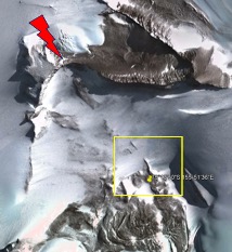
October 28, 2021 - In a previous article titled “Ancient walled city emerges from Antarctica’s ice,” we discovered the remains of a pre-ice civilization within the yellow box shown in the first satellite photo above. Since that posting, we’ve found more evidence about a mile away. |
 |
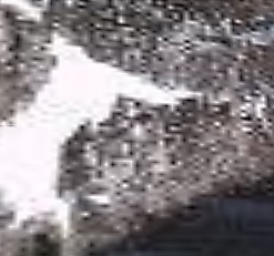
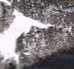
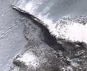
The red lightning bolt points to the newly found ruins which are enlarged in the photo on the right. Once again, perpendicular lines and box shapes practically shout that this was an intelligently designed city. |
|
Discoveries like this are history-blowing. Antarctica has been covered in ice for 34 million years according to most scientists, so the melting ice is revealing remnants of the world’s oldest civilization ever found.
Previous to the ice melting in Antarctica, the oldest known ruins were in South Africa, but they are only about 100,000 years old. That means Antarctica’s ruins are 340 times older. |
 |
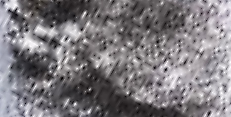
TRUTH ERASED - Before we could even finish writing about this discovery, Google Earth images of the site were suddenly distorted; the perpendicular lines no longer were visible. In less than an hour, evidence of a pre-ice civilization in Antarctica was erased. Why?
Compare the Google Earth images below. They are images of the same site in Antarctica taken an hour apart. |
|
So, if you ever find something unique when using Google Earth, make sure to hit the PRINT SCREEN key on your computer and save the image in your files. If it’s something others might find interesting, send the information to: brillobulletins@yahoo.com
These are the coordinates within the yellow box in
the first photo: 79°13'50"S 155°51'36"E |
 
UFOs flying past the ISS – Astronaut Jessica Meir who’s currently onboard the ISS
Uncountable UFOs flew past Space Station
Imagine being inside the International Space Station (ISS) and seeing an uncountable number of UFOs flying past the window. Fortunately, sky watcher Mary Hall was watching the ISS video feed at that moment and was able to save a copy of the video. – The editor
CLICK HERE to watch the 1:28 minute video
that Mary recorded at 2:11 a.m. on October 27, 2021.
Photos of UFO hovering on Moon’s surface
These photos of an apparent UFO hovering on the Moon’s surface are attributed to a member of the South Florida Amateur Astronomers Association at its Fox Observatory in Sunrise, Florida. When we called the observatory for additional information, we got a recorded message saying it was closed due to COVID. The photos appear to be real so we decided to post them. If we learn more, we will provide updated information. – The editor
|
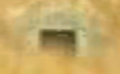
Ancient walled city emerges from Antarctica’s ice |
 |
Antarctica’s ice covering is melting quickly. That is bad for coastal areas around the world but good for discovering the remains of the continent’s pre-ice civilization.
The area within the RED box above is enlarged in the photo to the left. It reveals a wall and part of the city adjacent to it.
A portion of the area within the BLUE box is enlarged below.
The contrast has been increased in both photos so walls are easier to see.
|
|
The fortress-like wall in the above photo could be something else, like a bridge or a dam. Whatever it might be, it’s about 574 feet long. However, there’s a break in the wall that can be seen in the first photo, making the total length about 1,624 feet.
You can explore these ancient ruins by copying and pasting the following coordinates into your Google Earth search bar: 79°13'50"S 155°51'36"E
|
 |
SADLY, since we first looked at this site, it’s more blurred on Google Earth, and it’s impossible to zoom in for a closer look on Google Maps. It looks like a deliberate cover-up and we have to wonder why. |
|
Alien scout ship whizzed by ISS camera
An alien scout ship whizzed by the International Space Station (ISS) on October 6, 2021 at 12:29 a.m. (ET). Fortunately, Mary Hall was monitoring the ISS camera at that moment and was able to save the brief video. She later posted it on her “Mary Hall” YouTube channel. The above photos are from that ISS video.
While it’s rare to see ISS videos of this kind of craft, similar disc-shaped craft with a raised center often have been photographed from Earth. Below are sample photos. One was taken from Pagosa Springs, CO in January 2020 and one from Clayton, GA in April 2020.
The basic alien scout craft comes in various designs. Below are examples of some of them that have been drawn by Jimmy Catanzaro, a professional technical illustrator.
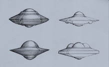 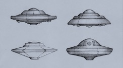
NOTE: A scout ship is a smaller craft designed for shorter “road trips.” When not scooting around, it may park within a large mothership – just like in the movies.
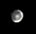
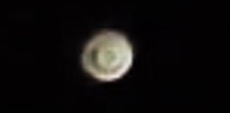
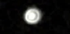
Astronomer Sir Patrick Moore coined the term Transient Lunar Phenomena in 1968.
Mysterious lights on the Moon
By Mary Joyce, website editor
Astronomers have been photographing mysterious flashes of light on the Moon since at least the 1950s. Today, astronomers call them Transient Lunar Phenomena (TLP).
The first photo below was taken by Dr. Leon Stuart in 1953. It’s the oldest TLP photo we found. It reveals a light at the edge of the dark side of the Moon. The other three photos have all been taken within the past few years.
The phenomena so intrigued Sir Patrick Moore and astronomer Barbara Middlehurst, that they teamed up and cataloged 300 TLP in an academic book titled “Chronological Catalog of Reported Lunar Events.” So far, astronomers and scientists have not come to a consensus on the cause of the lights. Indeed, there may be multiple causes.
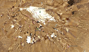
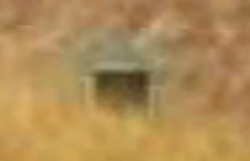
This satellite photo shows only part of an ancient metropolis recently discovered in Antarctica.
The photo contrast has been increased so the city walls easily can be seen.
Ancient city emerging NOW from Antarctica’s ice
By Mary A. Joyce
An ancient metropolis is emerging from Antarctica’s ice. It was discovered on September 18, 2021 by Mary Hall who discovered it using Google Earth. It was no quick find. She has been methodically searching for signs of a pre-ice civilization in Antarctica since May 2021.
Depending upon which scientist you talk to, Antarctica was once ice-free but has been covered in ice for 23 to 34 million years. So, Mary’s discovery is millions of years older than the remains of any other ancient civilization in the world. Compare it to the Great Pyramid which scholars generally agree was completed around 2560 BC – a mere 4581 years ago.
The above photo is only one snapshot of Antarctica’s newly-found ancient metropolis. It actually spreads out like cities do today. Below are three other satellite photos of the ancient metropolis. Again, the photo contrast has been increased so the city walls easily can be seen.
The following satellite photo shows how deep Mary “dug” in her search for ancient life in Antarctica. She plunged into the sliver-like cracks in the ice shown below. That is where she found the remains of the ancient metropolis.
Mary’s discovery is only part of her story. In June 2017, she had a most unexpected stroke when she was only 47 years old that almost killed her. Now she is disabled and limited in her physical activities. So, she spends a great deal of time using her computer to search for anomalies in the world and out in space that she thinks others might find interesting and posts them on her “Mary Hall” YouTube channel.
 
Mary Hall at her computer in 2021 and in the hospital after her stroke in 2017
With the help of her caregiver, Dale Dufay (R), they put together a video of her Antarctica discovery. It was made right after the discovery and you can hear excitement in Dale’s voice as he narrates the video of the site. Here is the link to the video: https://youtu.be/PnXuJ6SOhgs
On a personal note, I hope Mary’s story will encourage other disabled people to use their computers to reach out into the world. And, I hope Dale will inspire caregivers to become involved and supportive of their patient’s projects. |
 |
It is the hope of all three of us that archaeologists will be able to go to Antarctica and actually explore Mary’s discovery. If they do, we ask that Mary Hall be given full credit for making the discovery.
 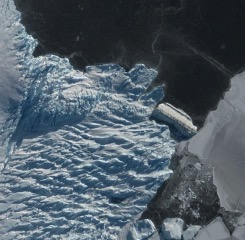
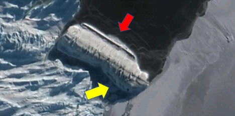
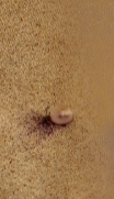
540-foot “canister” found on Antarctica’s coast
The above canister-shaped object was found wedged on the northern coast of Antarctica by Ed Johnson. Though its top is covered with ice and snow, there are two features indicating it’s more than a broken-off hunk of the continent. The yellow arrow points to window-like shapes in its side. The red arrow points to a smooth linear shape that runs nearly the entire length of the object. The object’s size is notable too. It’s about 540 feet long. – The editor
To explore the object for yourself, copy and paste the following coordinates into your Google Earth or Google Maps search bar: 67°26’03.22”S 60°53’04.67”E
Shape-shifting UAP seen from passenger jet
By Mary Joyce, website editor
On July 30, 2021, the hosts of “Breakfast Television” in Canada appeared befuddled when they were unable to explain a shape-shifting phenomenon captured on video by a German airline passenger. They weren’t the only ones amazed by this truly Unidentified Aerial Phenomena (UAP). Around that time, there were reports of the UAP as far away as India.
Well, only a portion of the video was broadcast. So, we looked for the original and found it. Unlike the TV morning show, the original video is seven minutes long and includes audio which gives credibility to the sighting. There is the constant sound of the jet’s engines; very faint muffled voices of passengers; and late in the video, the stewardess gives ordinary instructions to the passengers in both German and English. The video is worth watching.
Three frames of the UAP from the seven-minute video
But here’s another side of this story. The original video was posted on June 9, 2018. That means it took three years for mainstream media to catch up with the news. We’d like to thank Ed Johnson for suggesting that we look into this Canadian news report.
CLICK HERE to view the full video.

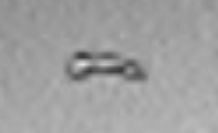
Tic Tac UFO caught 200 miles above Earth
We’ve seen quite a few military jet radar images of Tic Tac UFOs in the media this year. Well, one was caught on live camera feed from the International Space Station (ISS) the evening of August 31, 2021. Not only did it whiz by the ISS, it abruptly disappeared right in front of the ISS camera.
We think it’s significant that a Tic Tac UFO was seen 200 miles or 1,056,000 feet above Earth. Jets max out at 60,000 feet. That’s close to a million-foot difference. So, the altitude of the object, its speed and its ability to vanish instantly support the idea that Tic Tac UFOs are not likely manmade flying craft.
CLICK HERE to watch the brief video of the Tic Tac UFO flying past the International Space Station. It was caught by sky watcher Mary Hall. You can sky watch along with her on her YouTube channel “Mary Hall Anomalies.”
 |
Curiosity Rover camera caught
object above Mars
Rena Harp sent us 11 photos taken by NASA’s Curiosity Rover which landed on Mars on August 5, 2012. Each photo reveals the same object above the Mars surface only at different distances from Curiosity.
Unlike Perseverance, the most recent rover, Curiosity had no drone riding along with it. This means the object cannot be explained away as a drone.
One of the 11 photos is shown on the left. Below is an enlargement of the object at the top center of the photo.
|
 |
Possible remains of ancient
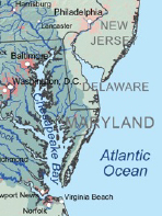
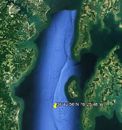
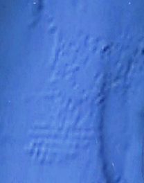
structures in Chesapeake Bay
At the northern end of Chesapeake Bay, Scott Askey discovered possible remains of ancient structures that may once have been above water. Perhaps they were community clusters along a river which today appears as a groove at the bottom of the bay.
Below is a Google Earth image of that section of the bay along with an enlargement of the northernmost cluster. It is 2.83 miles in length and reveals many crosshatch lines.
To explore the bottom of the bay for yourself, copy and paste these coordinates into your Google Earth search bar: 38°42’56”N 76°25’48”W |
|
  |
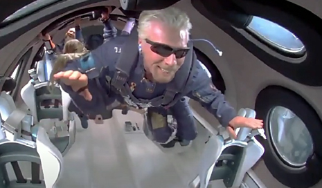
Richard Branson during weightlessness on his first Virgin Galactic flight
UFO caught by Virgin Galactic camera
Below is one of several frames from a video taken during Richard Branson’s first Virgin Galactic flight on July 11, 2021 that appears to show an unidentified spacecraft. Enlargements of the object also are shown from three different frames of the video. Notice the UFO looks much like a typical saucer-shaped UFO with a raised dome shape in the middle of the craft.
CLICK HERE to watch the 2:11 minute video
 |
“I’m seeing more UFOs and fleets of UFOs flying by the International Space Station than I’ve ever seen before.”
~~~
This is quite a statement from Mary Hall who monitors the International Space Station’s livestream camera feed more than anyone we know. – The editor |
|
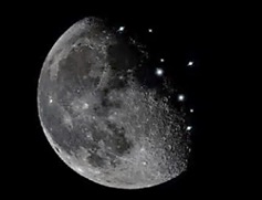
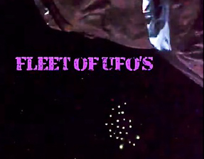
Two UFO fleets passed ISS in opposite directions
A fleet of 25 UFOs (above) was caught on livestream camera feed from the International Space Station (ISS) on July 10, 2021 by skywatcher Mary Hall. The fleet was moving from right to left. Two days later, a larger fleet (below) passed by the ISS moving in the opposite direction, from left to right on July 12, 2021.
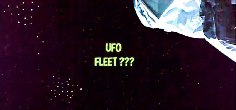
CLICK HERE to see the July 10, 2021 video
CLICK HERE to see the July 12 video |
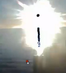
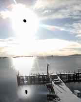
Black circle in front of Sun is something solid
There are people who dismiss the black circle often photographed in front of the Sun as a mere camera anomaly. However, the following webcam photos show the black circle reflected in water, indicating it is something quite physical. We would like to thank Mary Hall for helping us find and select a few sample photographs. – The editor
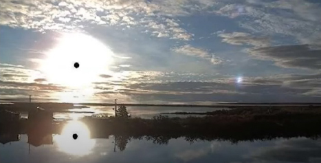
Selawik, Alaska
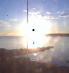 
Solvesborg, Sweden (vertical line is a flagpole) – Antarctica (from Australian facility)
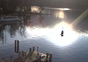 
Meisterschwanden, Switzerland – Nova Scotia, Canada
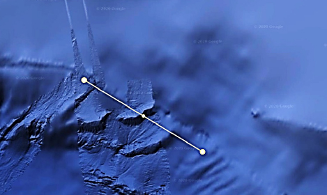
Undersea formation defies geological explanation |
 |
Scott Askey, another Google Earth explorer, found a most curious undersea formation off the coast of British Columbia, Canada and southeast of Alaska. It appears to be a remnant from ancient times that was deliberately created. But what was it? An airport? A mining operation?
Whatever it once was, it is not a natural geological formation. As for size, it is quite large. The yellow line in the image below is 32 miles long. |
|
We zoomed in for a better look at the lower portion of this undersea formation. That’s when we saw four parallel lines crossing the more dominant line at a right angle. – The editor
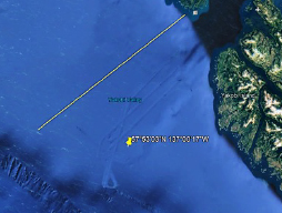 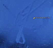
You can check out this ancient formation for yourself by coping and pasting these coordinates into your Google Earth search bar: 57°53’03”N 137°00’17”W |
Entrances into Mars – 27 all in a line
By Mary Joyce, website editor |
 |
We found at least 27 square-cut entrances into Mars that are in a straight line running from north to south. There may be more because it looks like efforts have been made to BLUR all but the tops of the entrances so they cannot easily be discovered.
It is impossible to show all the entrances in one photo because they are spread out over 16 miles but the first photo below shows four of them and how they align with each other. |
|
We’ve measured the width of four entrances and found them to be quite large. The yellow lines above the entrances in the photos below are 403 feet, 399 feet, 431 feet and 1,081 feet in length.
If you would like to check out these entrances for yourself, copy and paste the following coordinates into your Google Earth/Mars search bar: 50°19’06.06”N 25°01’02.54”E
which will take you to the most northern entrance.
To align the entrances horizontally, set the compass in the upper right corner of the screen so NORTH is in the EAST position. |
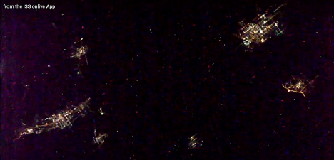
Colorful odd-shaped UFOs streamed by ISS
Colorful odd-shaped UFOs continuously streamed by the International Space Station (ISS) for more than two minutes on December 5, 2020. Many of them looked like pulsing electrical light grids. They were caught on live-feed video from the ISS by Mary Hall who monitors the Space Station regularly. It was about five months later that we discovered this video in her files. Two of the smaller UFOs in this screen shot have been enlarged below. – The editor
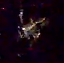 
CLICK HERE to view the 2:42 minute video.
It might be worth watching this on a full computer screen.
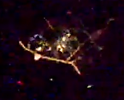
Three close-up views of UFO from the ISS
These UFO photos are from a live-feed video from the International Space Station. We had seen a similar YouTube video but without attribution, so we were concerned about its authenticity. That’s when we contacted Mary Hall, a trusted sky-watcher who frequently monitors the ISS. She went through her files and found a copy of the original ISS video. To the right of each original photo, is an enlargement of the UFO. – The editor
CLICK HERE to watch the minute-long video.
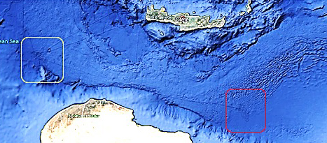
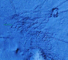
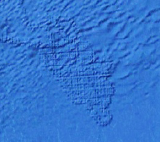
Possible sunken cities recently found
By Scott Askey and Mary Joyce
EDITOR’S NOTE: Following this posting are photos of two ancient submerged cities that divers have been able to explore because they are closer to Greek shores.
The remnants of two ancient cities may lie beneath the Mediterranean Sea south of the Greek island of Crete. When we zoomed in on the two boxed areas on the map, city-like grids were revealed. The distance between the two is approximately 450 miles.
As if to support the possibility of sunken cities, there is a line on the seafloor that might have been a road connecting the two. There also are connecting lines to Crete and other elevated areas that may once have been above water.
|
 |
Plato, the founder of the Academy in Athens wrote:
“Many great deluges have taken place during the nine thousand years, for that is the number of years which have elapsed since the time of which I am speaking; and during all of this time and through so many changes, there has never been any considerable accumulation of the soil coming down from the mountains, as in other places, but the earth has fallen away all round and sunk out of sight. The consequence is, that in comparison of what then was, there are remaining only the bones of the wasted body, as they may be called, as in the case of small islands, all the richer and softer parts of the soil have fallen away, and the mere skeleton of the land being left.”
Plato lived between 427BC and 347 BC. |
|
Photos of two ancient sunken Greek cities
By Mary Joyce, website editor
The following photos of two ancient submerged Greek cities support the idea that our Google Earth search (shown in previous posting) may have revealed two more ancient sunken cities that lie deeper and further from shore.
One of the remains of the ancient sunken Greek city of Pavlopetri
PAVLOPETRI is believed to be the oldest underwater city in the world. It was built about 5000 years ago and destroyed by earthquakes around 1000 BC. Yet, it wasn’t rediscovered until 1967 and mapped a year later by archaeologists from the University of Cambridge.
From what has been uncovered so far, the ancient city covers at least 50 square miles and resembles modern-day cities with well-designed roads, houses, gardens, temples, a large open plaza and a complex water management system.
According to the SportDiver website, anyone with a snorkel can see the ruins which lie at a depth of 12-13 feet off the shore of Pouda Beach, Greece.
Ruins of the ancient sunken Greek city of Olous
|
OLOUS is another ancient sunken Greek city. It lies off the coast of Crete near the town of Elounda. During its peak, the city had more than 30,000 residents. It was destroyed by an earthquake in 780 AD.
Much of the Olous can be seen from the surface of the sea. If you would like to explore the ruins for yourself, the Blue Dolphin Diving Center in Elounda offers guided snorkeling tours of the site.
(R) One of many Olous coins found at the site |

|
|
 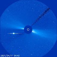  
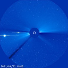
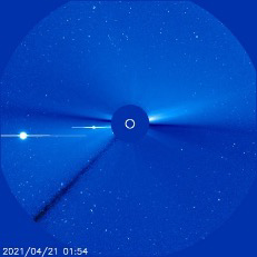
Sampling of NASA photos of a UFO near the Sun slowly traveling from right to left
Whopper UFO next to Sun at least 57 days
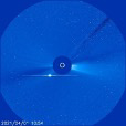
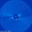
By Mary Joyce, editor
It had been quite a while since we checked the live feed from NASA’s LASCO-3 SOHO satellite camera which snaps a photo of the Sun every 12 minutes. When we did, we found a whopper UFO. We don’t know how long the UFO was there before we discovered it, but we observed it for 57 days (March 3 to April 28, 2021) before it disappeared from view.
It should be explained that the dark disc in the center of each photo is there to protect the satellite camera from the Sun’s intensity and just barely covers the Sun which is 864,938 miles in diameter. So, the size of this UFO is too big for most of us to truly imagine.
During the 57 days we observed the UFO, the following photos stood out from the rest. On April 11, a second and quite different object also appeared. The shadowing indicates it was canister shaped, but it’s puzzling that the illuminated side did not face the Sun.
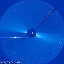 
The canister-shaped object is enlarged on the right.
Then on April 21 and 22, a UFO appeared that was similar in shape to the original one we were following. It was either smaller in size or more distant. It also traveled from right to left.
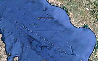 
The ancient undersea runway (L) is similar to contemporary airport runways
like the one at St. Pete-Clearwater International Airport (R).
Looks like a huge submerged ancient airport
By Mary Joyce, website editor |
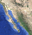
After we posted Google Earth discoveries of ancient ruins off the California Coast, we’ve heard from others who have plunged into their own underwater exploration. Several of them found the above undersea formation in the Gulf of California, east of the Baja Peninsula.
It looks like an airport runway for gigantic aircraft. The yellow line along the length of the runway is 89 miles long. Compare that to the world’s longest runway today which is a mere 3.42 miles in length. Another ancient submerged structure also is gigantic. Scroll down to “Evidence of ancient civilization off California coast” to learn about it. |
|
|
Check out the runway for yourself by copying and pasting the following coordinates into your Google Earth search bar: 26°50'31"N 110°37'00"W |
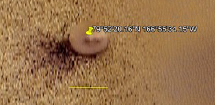
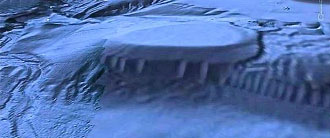
| Satellite photo of spacecraft parked on Mars - UPDATE |
APRIL 2021 UPDATE: With all the attention on Perseverance and its tiny helicopter on Mars, we went back to this 2015 article to add a more precise measurement of the craft. The yellow line in the photo to the right is 3.58 miles long, which means the craft is approximately 63 football fields in diameter.
|
 |
|
We want to thank the people at “Secureteam10” for locating an object on Mars that looks like a parked spacecraft and for providing its longitude and latitude coordinates.
79°52'20.16"N 166°55'34.15"W
On May 14, 2015, we went to Google Earth/Mars. Using the above coordinates, we found these satellite images for ourselves. They appear to reveal a very large circular object parked just below the Mars polar ice cap. Since the object casts a shadow on one side, it cannot be a crater.
The third photo below shows a view from approximately 20 miles above Mars so the object has to be huge. Compare it to a photo of the Eiffel Tower taken from 20 miles above Paris. The tower is the tiny red dot in the middle of the image directly south of the arch in the Seine River. – The Editor
|
Footprint of ancient undersea structure off California Coast (L) and one off New Jersey (R)
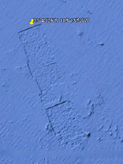
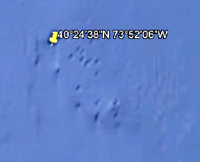
Ancient undersea ruins off New Jersey coast
By Mary Joyce, website editor
Scott Askey found a footprint of an ancient undersea structure off the coast of New Jersey that is quite similar to one he found off the California Coast (see California’s undersea ancient ruins #5 below). While the New Jersey structural footprint is blurry, the geometric shape is still discernible.
Surprisingly, the New Jersey structure is 39 football fields in length while the California ruins is only about 18 football fields in length. That is a difference of 21 football fields.
We also observed “pockmarks” to the right of the New Jersey ruins and could not find any others like them anywhere nearby on the U.S. Continental Shelf. Notice they are all aligned at approximately 45 degrees. This opens the door to speculation. Could the ancient ruins have been bombarded by asteroids or actual bombs? Could the pockmarks be the result of an ancient mining operation? Could they simply be footprints of smaller ancient structures adjacent to the large one?
To explore the New Jersey ruins for yourself, copy and paste the following coordinates into your Google Earth search bar: 40°24’38”N 73°52’06”W
Remnants of undersea structures off Alaska’s coast
By Mary Joyce, website editor
NOTE: We would like to thank to Colin Andrews for suggesting that we explore this area off the southern coast of Alaska. He usually stays above water researching and writing books about crop circles. His books are available on Amazon. |
 |
We found two possible remnants of an ancient undersea civilization off Alaska’s southern coast. The one on the left is a stand-alone rectangular shape composed of multiple rows. It is nearly five miles in length.
Also notice the loop formation to the right of the rectangle. It connects with a larger ruin immediately south of it which is shown in the photo below. |
|
Though it’s a fuzzy image, it is clear there are many right angles above the yellow line in the above photo – a sure indication of an intelligently-designed structure. It also is a large structure; the yellow line is 23 miles long. This photo may have been blurred intentionally because the area below the line is more in focus even though it appears it may be in deeper water.
To find these ruins for yourself, copy the following coordinates into your Google Earth search bar: 59°58'47"N 143°37'46"W |
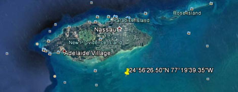
Bahamian pyramids – Before and after cover-up
By Mary Joyce, website editor
Right off the bat, I want to encourage anyone who finds an interesting Google Earth discovery to press the “PRINT SCREEN” key on your computer and save it for your files. Why? Because the infamous “they” often wipe away or distort the images so they can’t be seen again.
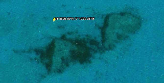
In 2018, we posted an article about the discovery of two undersea pyramids (above) that were found south of Nassau Island. Those no longer can be found using Google Earth. They have been covered up with satellite photo strips. This cover-up effort might actually confirm the existence of the pyramids.
Compare the two Google Earth images below. The first is from 2018. When we returned to the location in 2021 (second photo), we found all of Nassau Island had been slightly blurred and satellite photo strips had been added where the pyramids originally were found. Even all the square site markers around the island had been eliminated. Most significantly, no trace of the pyramids could be found.
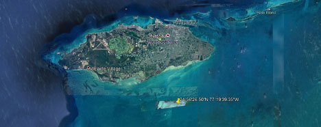
Check it out for yourself by copying and pasting the following coordinates
into your Google Earth search bar: 24°56'26.50"N 77°19'39.35"W
Marker on the map shows location of ancient ruin on the right.
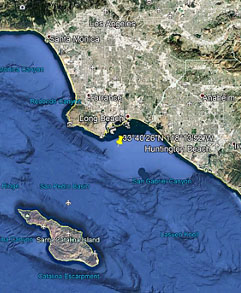
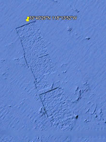
California’s undersea ancient ruins #5
Another footprint of a large ancient undersea structure has been found between Long Beach and Huntington Beach, California. It was found by Scott Askey of New York. It is 1,782 yards long and 393 yards wide, or nearly 18 football fields long and four wide.
It’s worth noting that Scott previously lived in Arizona and spent some of his spare time searching for the Lost Dutchman’s Gold Mine in the Superstition Mountains. Now, he uses Google Earth as his “shovel” for finding archaeological ruins like this one.
To find the ancient site for yourself, copy and paste the following coordinates into the Google Earth search bar: 33°40'26"N 118°13'52"W
Latest Mars Rover is a diversion – Evidence #1
By Mary Joyce, website editor
With all the hoopla over the Perseverance Rover landing on Mars on February 18, 2021, you would think the USA was just beginning very basic discoveries on the planet. NOT SO. For over a decade, we’ve found evidence of intelligently designed contemporary structures already established there.
In 2011, we posted a Google Earth/Mars image of what appears to be a biosphere in the northern hemisphere of Mars. It is no small thing, measuring approximately 700 feet in length.
Then in 2016, we posted a Google Earth/Mars image of a similar structure in the southern hemisphere. This one is about 10 times larger, measuring approximately 7,000 feet long.
The coordinates for each biosphere are included below so anyone can copy and paste them into the Google Earth/Mars search bar and find them. It might be wise to hit the Print Screen button on your computer to save the images because there is a history of such evidence being distorted or wiped away.
MARS NORTHERN HEMISPHERE - 71 49'19.73"N 29 33'06.53"W
MARS SOUTHERN HEMISPHERE - 79°16'50.46"S 68° 9'27.41"W
To add validity to these structures, compare them to the illustration below (L)of a space biosphere designed by Bryan Versteeg. He is a conceptual architectural and engineering artist who has done concept illustrations for the Mars Foundation, Deep Space Industries and Interorbital Systems, plus “Mars Exploration Magazine” and “New Scientist” publications.
|
Latest Mars Rover is a diversion – Evidence #2
By Mary Joyce, website editor
|
 |
This is a reprint of an article we posted in 2020. It is a space security expert’s declaration that the USA already is involved in significant projects on Mars that go way beyond the basic exploratory mission of the Perseverance Rover that landed on the planet on February 18, 2021.
|
|
 |
Space security expert reveals
alliance with space aliens
Professor Haim Eshed (L) served as the head of Israel’s Security Space Program from 1981 to 2010 and has received the Israel Security Award three times, twice for confidential technological inventions.
Recently, Eshed went public about the long-term involvement of Israel and the United States with the Galactic Federation which is an alliance of various alien races.
Below are his exact words as published in The Jerusalem Post on December 8, 2020. |
|
“The UFOs have asked not to publish that they are here, humanity is not ready yet. Trump was on the verge of revealing, but the aliens in the Galactic Federation are saying: Wait, let people calm down first. They don’t want to start mass hysteria. They want to first make us sane and understanding.
“They have been waiting for humanity to evolve and reach a stage where we will generally understand what space and spaceships are. There’s an agreement between the US government and the aliens.They signed a contract with us to do experiments here. They, too, are researching and trying to understand the whole fabric of the universe, and they want us as helpers.
“There’s an underground base in the depths of Mars, where their representatives are, and also our American astronauts.
“If I had come up with what I’m saying today five years ago, I would have been hospitalized. Wherever I’ve gone with this in academia, they’ve said: the man has lost his mind. Today they’re already talking differently. I have nothing to lose. I’ve received my degrees and awards, I am respected in universities abroad, where the trend is also changing.”
|
Latest Mars Rover is a diversion – Evidence #3
By Mary Joyce, website editor
Back in 2015, we posted images of huge entrances into the interior of Mars. Some were in the craggy area of the first photo below. Then in 2021, we used Google Earth/Mars to return to that location. It had been wiped clean (second photo) which is an indication something significant is happening in that area which goes way beyond the very basic exploratory mission of the Perseverance Rover.
You still can see some of the huge Mars entrances in the following article we posted in 2016 titled “Many underground entrances found on Mars.”
Since we posted a photo story in 2014 titled “Entrance into Mars interior discovered,” more satellite images of Mars entrances have been revealed in a video posted December 5, 2015. At first glance, they may seem to be the same entrance, but a closer look reveals different dimensions as well as different details around the edges of the entryways.
According to estimates by Stephen Hannard who discovered the first entrance (5th photo below), it is huge - approximately 3700 feet high and 528 feet wide.
Below, the yellow arrows in the two photos point to the same entrance. Note that left and right of that entrance there appear to be large entryways that have been nearly wiped from sight with an airbrush.

Other possible examples of Mars entrances almost completely airbrushed from view can be seen in the three satellite images below.
CLICK HERE to view a nine minute YouTube video about Mars entrances that was posted on December 5, 2015. It shows how the entryways were found and includes commentary.
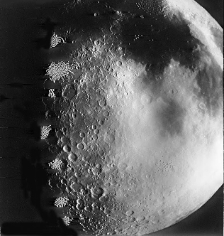
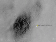
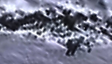
Mystery at edge of Moon’s dark side
By Mary Joyce, website editor
Right on the edge of the dark side of the Moon there appear to be clusters of puzzling formations in this photo that don’t look like anything we’ve seen before in Moon photos. This one is from the book “Lunar Orbiter Photographic Atlas of the Near Side of the Moon” by Charles J. Byrne who did research and systems engineering and development for Bell Laboratories and other subsidiaries of AT&T.
 
Charles J. Byrne and his book
“My responsibility,” Bryne has explained, “was gathering information and planning for the selection of lunar landing sites that were both safe and scientifically rewarding.”
Thirty-two years after the last Lunar Orbiter mission in 2001, a collection of the mission’s photos was put on the website of the Lunar Planetary Institute. By then, personal computer technology had advanced so Bryne was able to clean up satellite-to-Earth transmission interference for better clarity. |
 |
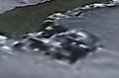
After learning that some Lunar Orbiter photos were available to the public, we became detectives and were surprised by what we discovered. Photo 5019 from the Lunar Orbiter V mission (below) reveals clusters of UFOs near the Moon that look remarkably similar to the clusters in the photo above from Byrne’s book. But the mystery doesn’t stop there. In the very next photo, frame 5020, the UFO dot pattern has totally changed. By photo frame 5024, no trace of the UFOs can be seen.
|
|
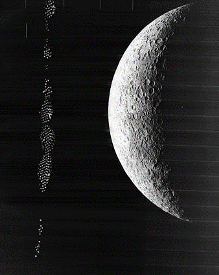 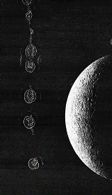
Photo frames 5019 and 5020 taken from the Lunar Orbiter V mission |
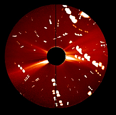 
NASA Secchi satellite photos from December 12, 2020 and April 29, 2017 |
Swarm of giant lights
appears near Sun
We rarely get to catch momentary flashes of giant lights around the Sun like those above. The photo on the left was taken by NASA’s Secchi satellite camera (R) on December 12, 2020.
The last time we caught a similar explosion of lights was on April 29, 2017. To appreciate the enormous size of these lights, Earth is smaller than the smallest white dot in the left photo. – The editor
NOTE: The dark circle in the middle of each of the above photos is a shield that protects the satellite camera (R) from being burned out by the intense light of the Sun. |

|
|
Undersea ruins found by stroke survivor
By Dale DuFay and Mary Joyce
  
Mary Hall in 2016 ● In 2017 when she almost died from a stroke
● In 2020 wearing a T-shirt she won from a YouTube channel she monitors
Mary Hall hasn’t let a stroke slow down her curious mind. She uses her computer as a detective tool. Below are three of her undersea discoveries that may be ancient ruins of pre-flood civilizations. Learn more about Mary at the end of this posting.
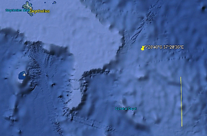
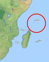
DISCOVERY #1 - Near the Seychelle Islands, which are off the coast of Africa and north of Madagascar, Mary found a near perfect undersea circle formation. It is directly below the yellow push pin on the Google Earth map below. The yellow line measuring its approximate diameter is 60.8 miles long. To explore this for yourself, copy and paste these coordinates into your Google Earth search bar: 5°28'40"S 57°28'35"E
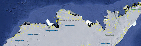
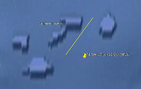
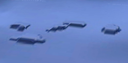
DISCOVERY #2 – While exploring a bay on the north coast of Antarctica, Mary found a cluster of four undersea structures. The yellow push pin points to their location. Below the coastal map are two views of the structures. The yellow line in the first Google Earth image is 3.7 miles in long. Here are the coordinates for this find: 74°09'47"S 103°23'28"W
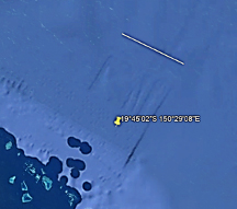
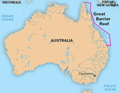
DISCOVERY #3 – Mary found a third undersea formation off Australia’s Great Barrier Reef. The yellow line shows that the rectangular formation is approximately 13.8 miles wide. The coordinates for this location are 19°45'02"S 150°29'08"E
|
MESSAGE FROM DALE DUFAY,
MARY’S CARETAKER:
“Mary’s not totally bedridden, however, she does most of her research from there. She monitors multiple sites on two monitors, up to 16 hours a day - sometimes, even in her sleep! She monitors the International Space Station Live feed, NASA SOHO satellite images, Mars Rover images, and multiple feeds on the EarthCam Network.
“Plus, Mary does Google Earth and weather map searches and follows many related YouTube channels. Her favorite YouTube channel is MrMBB333, where he shares much of her work, almost on a daily basis! |

|
|
“Mary was born with a good attitude and work ethic and I see her work zealously at her computer every day, every waking moment, beyond her other routines in life. She has a keen eye and is able to see what others can’t, but once she points them out, they clearly can be seen by anyone.
“Obviously, this work really helps; you couldn’t ask for better therapy. It gives her a worthwhile purpose and she’s very grateful to have some of her discoveries posted on the Sky Ships Over Cashiers website.” |
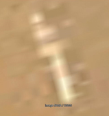
UFO skids to a stop on Mars - Photo
By Mary Joyce, website editor
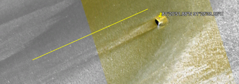
December 2020 - The above object appears to have skidded almost a mile across the Mars surface before slamming to a stop. The yellow line running parallel to the skid mark is 4,422 feet in length. The object itself is approximately 406 feet long and 367 feet across.
The intense yellow on the object could be an indication of heat created by an intense landing. The white flare might be a reflection off the object since it shines on the Mars surface too.
To find the object for yourself, copy and paste these coordinates into your Google Earth/Mars search bar:
81°20'51.88"N 91°28'38.86"E
Entrance hole into Mars cavern - Photo
By Mary Joyce, website editor
According to NASA, this 115-foot-wide hole into the interior of Mars was discovered on the planet’s “dusty slopes of the Pavonis Mons volcano.” It was photographed by the Mars Reconnaissance Orbiter in 2011 but not posted for the public to see until March 1, 2020. The photo caption includes this interesting statement by NASA astronomers:
“Why there is a circular crater surrounding this hole remains a topic of speculation, as is the full extent of the underlying cavern. Holes such as this are of particular interest because their interior caves are relatively protected from the harsh surface of Mars, making them relatively good candidates to contain Martian life. These pits are therefore prime targets for possible future spacecraft robots, and even human interplanetary explorers.”
CLICK HERE to see the NASA page for yourself. It’s worth noting that when we searched for this hole on Google Earth/Mars, we could not find it. Instead, we only saw a mishmash of out-of-focus satellite photo strips around the Pavonis Mons volcano.
Evidence of ancient civilization off California coast
By Mary Joyce, website editor
So far, we have found evidence of four undersea ruins of a prehistoric civilization off California’s coast. The yellow push pins point to the locations. The existence of these ruins might indicate the “mythical” land of Lemuria that sank into the Pacific Ocean was real.
The first ruin, shown below, was discovered in May 2014. Follow this link to learn more about it: www.skyshipsovercashiers.com/globallinks2014.htm#malibu. The other sites have been discovered since then and are individually featured in the following three articles.
California’s undersea ancient ruins #2
By Mary Joyce, website editor
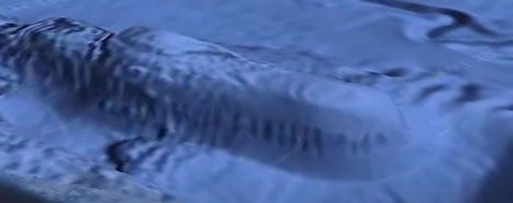
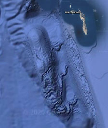 
A four-mile-long ancient structure was found on the ocean floor off the coast of California in October 2020. It appears to have columns or perhaps a portico around its exterior. The wall around it slopes. When looking straight down on the structure, the spaces between the columns appear as dark dots.
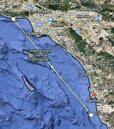
This latest ancient undersea discovery is somewhat similar to one found off the coast of Malibu, CA in May 2014. The yellow line on the map connects the two locations which are about 230 miles apart. To find the structure for yourself, type Isla Coronado in your Google Earth search bar. The structure is too big to miss and dwarfs the island.

California’s undersea ancient ruins #3
By Mary Joyce, website editor |
The above Google Earth image looks like the footprint of an ancient walled community. It was discovered on the ocean floor between Long Beach and Huntington Beach. Its many right angles indicate it was intelligently designed.
To help visualize its size, the yellow line is more than 1500 yards, or 15 football fields in length.
It was found in the flat light blue area between the two cities. Significantly, this is located about 46 miles south of the ancient undersea structure discovered off the coast of Malibu, CA in May 2014. |
|
|
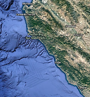 |
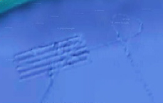
California’s undersea ancient ruins #4
An unusual pattern of equally spaced perpendicular lines has been found on the ocean floor due west of Gorda, CA and south of Pfeiffer Big Sur State Park.
The pattern looks like it could be a farmer’s field, but it is not a small field. The longest length in one direction is 25 miles and 28 miles in the other.
The individual dark stripes are large too, varying in width from one to 1.43 miles.
This pattern doesn’t look like it was created by nature and we did not find any other patterns like this along the California coast. – The editor |
|
|